I am not writing this blog as an endorsement for any particular product or app. Instead, I am writing this blog to explain how utilizing ONXmaps helped me bag my turkey this spring. Without this app, I would not have finished the deal. I am speaking only to ONXmaps as it is the program I use and prefer, however, there are many other fantastic apps out there that offer 3-D mapping and GPS services.
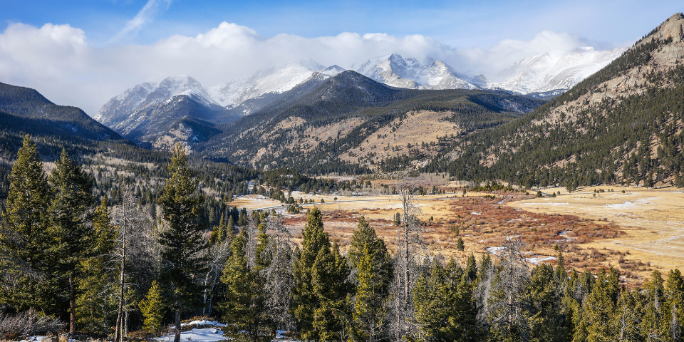
Public land turkey hunting in Colorado is no easy endeavor. There is no baiting allowed in Colorado. It is essentially a run-and-gun hunt if you do not have a property with roosting birds. But, that is what makes turkey hunting in the Colorado mountains so much fun!
This year, I headed out on Opening Day to a general area where I hunt each spring. There are definitely turkeys in this area and I have killed a few over the years. Small pieces of public land are woven between ranches and homes in this vicinity. The trick is catching the birds as they cross over the public land to return to private land.
Over the years, we have found many of the zones they travel through, and catching them there is often hit or miss. Throwing out some yelps or an occasional gobble can help you locate the birds and with luck, they will come on to you. Just as often, however, they will remain on private land and not make the move. That’s just turkey hunting.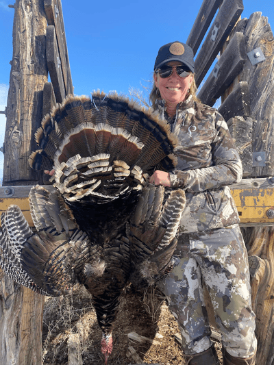
This year, we encountered several birds. It was early in the season and they were not as vocal as usual. We made numerous attempts to call and stalk during the morning. Nothing was really working so we opted to pull out and work in a new area.
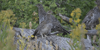
After some hiking and calling, we located a group of hens with two active toms. We worked our way within about 100 yards but found the birds to be on the other side of a fence line.
We couldn’t get the birds to cross on over and decided to double-check the ONXmap app on my phone. It turns out that this was a fantastic idea!
We were able to locate our exact location and found there to be a very small corner of BLM land that touched the fence line. After about 15 minutes of studying the maps and looking at where the turkeys were moving, it turned out that the birds were indeed located on that small corner of the land.
I stalked in closer and kept the ONXmap on as I did so to ensure I was not trespassing at any point. The birds remained across the fence but had not moved from the corner of BLM land.
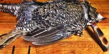
As I got into shooting range, I actually took a screenshot of my location so I could have proof that I was indeed on public land. The birds were above me on a hill and maneuvering into a shooting position took some time.
I was able to move myself behind a tree where I could pull up my shotgun with some cover. I had a nice tom beaded and he was about 15 yards away. One quick shot and the deal was sealed! I moved to grab the bird and I marked the bird’s location on my phone as well to further ensure I was indeed on public land.
I am always so excited when I am able to fill my spring turkey tags in Colorado. I have to admit, that if I had NOT had my ONXmap app, I would never have pursued that group of birds and never would have been able to seal the deal on opening day. I am now loaded with great memories and a freezer full of delicious birds.
About the Author